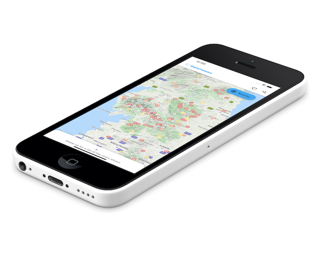
UK Whitewater Kayak Guides

NEW! You can add email alerts if a calibrated river rises above a level you choose. Use the login link in the menu to login via Facebook, then configure your alert on the river guide page. If you're technically minded, you might also be interested in the launch of the Rainchasers developer API. Feedback welcome.

... searches 514 river trips.
e.g. "grade 3 Llangollen"

Re: Teme

Cheers for the info... The info we have is that the wave closes out at about 0.9 but as the river continues to rise it opens back up into a green wave before eventually washing out at about 1.35m. Is this right? Are you able to check this next time it gets big? Cheers!

·· Tim Burne, 22-May-2013

Re: Linhope Burn

Guide info from Stu Ridley.

·· Jim Pullen, 18-May-2013

Re: Teme

I think it is worth noting that currently there is a wave at the edges and a hole in the middle. The hole can be very fisty at higher levels. We normally use an eddy maker on the one side to make entering the wave easier. I would suggest that 0.35 would be the lowest anyone would want to visit and 0.9 Is around the max. Look for knightwick surf warriors on Facebook for me info

·· Charles Chucky Adam Walker, 17-May-2013

Re: Sprint

The gauge reading seem to have changed by .2 after it was broken a few weeks back. Take .2 off the reading ie .5 now is really .3!

·· Dave Hewitt, 12-May-2013

Re: Wharfe

The Grassington EA gauge which this was calibrated against (http://www.environment-agency.gov.uk/homeandleisure/floods/riverlevels/riverstation.aspx?StationId=8087) has been non-functional for a while now, so I have removed it -- we'll need to find a new benchmark.

·· Rob Tuley, 10-May-2013

Re: Plym

I've added a scrape calibration here at 0.4; based on Andy's comment this is probably about right.

·· Rob Tuley, 10-May-2013